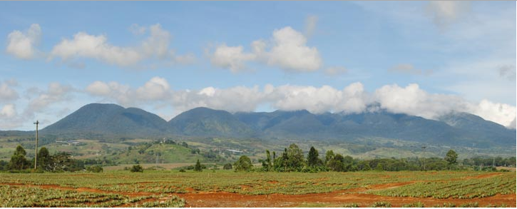
A protected area that centers on Mount Kitanglad and other high peaks in the volcanic Lanao-Bukidnon highland area in north central Bukidnon in the Philippines, the Mount Kitanglad Range Natural Park or MKNRP has a highest elevation of 2,938 meters above sea level in Mount Dulang-Dulang, which possibly the 2nd-highest mountain not just in Mindanao, but in the entire country. This national park enjoys an average temperature that ranges from 22.7 to 24.6 degrees Celsius. Because of its diversity, the mountain range was declared a protected area in 2000. For climbers, they said that conquering it was strenuous, which mostly took them 2 days.
Location
The MKNRP is located in north central Bukidnon, with an area that covers nearly half of the northern part of Central Mindanao.

Brief History
Over the years, Mount Kitanglad’s ecosystem is threatened by invasive agricultural practices, profligate and illegal logging, and forest fires that resulted in the partial denudation of its forest cover. In 1989, it was proposed by the Sangguniang Bayan of Sumilao that the mountain should be declared as a national park, and so it did become one the following year under Presidential Proclamation no. 677 that was issued on December 14, 1990. The designated national park includes areas of public land within the mountain range in 1996, while the areas along the periphery were declared a buffer zone. In 2000, the entire mountain range was declared a protected area, this the official name, Mount Kitanglad Range Natural Park.
The area’s protection measures were placed under the responsibility of 7 municipalities and the City of Malaybalay City, which united to create a Protected Area Management Board (PAMB), which then gained the support of 3 major ethnic groups that are living in the park area, namely the Talaandig, the Bukidnon and the Higaonon tribes. Volunteers, known as the Kitanglad Volunteer Guards (KVG), are also there to help protect the park.
Geographical Features
Covering an area of 31,297 hectares, the entire national park includes at least a dozen peaks, with 5 high-elevation mountain peaks in Mount Kitanglad, Mount Maagnaw, Mount Lumuluyaw, Mount Dulang-Dulang and Mount Tuminungan. Aside from these peaks, the park also has hot springs, caves and waterfalls, which help generate the MKRNP’s hydroelectric power, provide irrigation needs to Bukidnon’s agricultural lands and serve as the primary source of water, particularly from the Bubunawan River that is the main water source for Cagayan de Oro.
Attractions and Landmarks

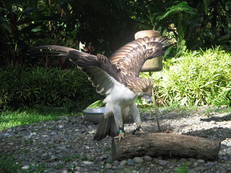
The main activities travelers and holidaymakers can engage in at the MKRNP are bird watching and mountain climbing. At the base of Mount Kitanglad is Lawan Dalawangan, which is a haven for the Philippine Eagle, and numerous springs and lakes that are ideal for swimming. Cave explorers would enjoy the enormous Panyak Caves, which boast of beautiful stalagmite and stalactite formations, and other tourists would find the Del Monte Philippines plantation and its golf course very enticing.
Animal and Plant Life
The mountain is inhabited by a wide variety of wildlife, especially birds, which at least 200 species, including the Philippine eagle, the serpent eagle, the Philippine sparrow hawk, the Brahmin kite and the red harrier, have been recorded to be found in the park. Aside from this, the MKRNP is home to a variety of rare and endemic species, including wild orchids.
How to Get There
Travelers can get to the MKNRP from Cagayan de Oro by taking public buses and jeepneys that runs through the Cagayan-Bukidnon routes.